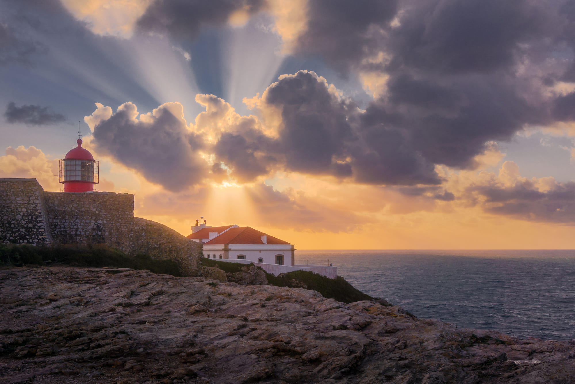
Prints are available on My website Follow me on Instagram Follow me on Steemit Join me on My Facebook Page The lighthouse of Cabo de São Vicente was about 6 km from our base in Sagres. Driving to the lighthouse, I have noticed the changes in the weather. A storm was coming. On the cape the wind was such strong, so I hardly could stay in place. The waves was big and powerful. While I was gazing at the waves, the light had changed, the sun hid behind a cloud, and the very strong sunbeams pierced the sky. Absolutely ethereal moment! About the place (wikipedia) Cape St. Vincent is the southwesternmost point in Portugal. It forms the southwestern end of the E9 European Coastal Path, which runs for 5,000 km (3,100 mi) to Narva-Jõesuu in Estonia. Approximately six kilometers from the village of Sagres, the cape is a landmark for a ship traveling to or from the Mediterranean. The cliffs rise nearly vertically from the Atlantic to a height of 75 meters. The cape is a site of exuberant marine life and a high concentration of birds nesting on the cliffs, such as the rare Bonelli's eagle, peregrine falcons, kites, rock thrushes, rock pigeons, storks and herons. The present lighthouse is 24 metres (79 ft) high and was built over the ruins of a 16th-century Franciscan convent in 1846. This lighthouse, guarding one of the world's busiest shipping lanes, is among the most powerful in Europe (the most powerful being Phare du Creach on the French island of Ushant, off the coast of Brittany); its two 1,000 W lamps can be seen as far as 60 kilometres (37 mi) away.
 Cape St Vincent
